This short 4-minute video (below) is an excellent
simulation of the B25 bombing runs to the Brenner Pass by US Air Corps in 1944. It was produced and published
by Doug Cook & Harry George Jr. They created it by simulating the flight directly on Google
Earth imagery over a USGS base map.
What
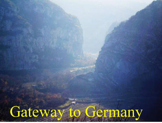
makes this video so excellent is the perfect view of the Adige River Valley as described and narrated in "The War of
Lions". The natural features (mountains and stream) have not changed since 1944. The communities, instead, have become more populated and shows the new Brenner super-highway which did not exist
in 1944.
Still, what
you see in this short 4-minute video are the same communities that existed in 1944, including Volargne (re-built) and
nearby Dolcé, and 'La Chiusa di Ceraino.'
No doubt that the 'bird's eye view' originally seen by the B25 pilots had to be almost the
same as you'll see in this video.